4 Easy Ways to Verify Property Lines
When you look at a beautiful piece of raw, vacant land, it’s easy to fall in love with the view, the mature trees, and the ultimate sense of freedom. However, because raw land doesn’t come with neat suburban fences, one of the most common hurdles buyers face is that vacant property lines can be tough to distinguish at first glance.
Wanting to know the exact measurements of your investment is completely natural. The great news is that learning how to verify property lines is much easier than you think! We want you to feel 100% confident in your purchase, and modern technology has made checking property boundaries incredibly straightforward.
If you are getting ready to buy your dream lot, here are the top tools—including a few secrets we often provide right in our listings—to help you find those lines with ease.
1. Leverage the Plat Map to Check Property Boundaries
Whenever you are looking at a vacant lot, always ask the seller if they have a plat map (or parcel map). At CheapLandFarm, we frequently pull these maps for our properties to make things as transparent as possible for our buyers!
- What it is: A plat map is an official map drawn by a surveyor that shows the exact dimensions, angles, and boundary lines of a piece of land relative to the surrounding lots. You can learn more about how these records work via the Bureau of Land Management (BLM) Cadastral Survey.
- How to use it: A plat map gives you the precise footprint of the lot. You can use the listed property measurements (like “150 feet by 300 feet”) to get a perfect understanding of the land’s shape and size before you even visit.
2. Use the onX Hunting App to Verify Property Lines in Real-Time
You might know onX Maps as a popular hunting app, but it has quickly become one of the absolute best tools for everyday land buyers who want to locate land markers.
- How it works: The app uses your phone’s built-in GPS to track your physical location in real-time, even if you lose cell service out in the wilderness.
- Why land buyers love it: It features a robust “Public/Private Land” layer that overlays county parcel boundaries directly onto a live satellite map. As you walk the dirt, you can look down at your screen and see exactly where you are standing in relation to the property borders. It turns your smartphone into a highly accurate, interactive boundary guide.
3. Tap Into County GIS Mapping Systems
Before you even leave your house, you can do some excellent digital scouting right from your computer to check property boundaries.
- Digital Scouting: Most local governments maintain a public GIS (Geographic Information System) website. You can find links to your local county backend through databases like NetrOnline Environmental Data to look up public land records.
- Instant Visuals: By typing in the property’s APN (Assessor’s Parcel Number), you can view a satellite overlay of the property boundaries. Combined with the plat map, this gives you a great visual grasp of the landscape.
4. Locate Land Markers and Existing Survey Pins
In many cases, the land has already been professionally surveyed in the past, meaning the physical markers are already there waiting for you.
- What to look for: Look near the corners indicated on your plat map. Original surveyors typically drive iron rebar or pipes (often topped with bright plastic caps) flush into the earth.
- Pro-Tip: If leaves or brush have covered them over the years, bringing a simple metal detector to the property is a fun and highly effective way to find property lines by pinpointing those original pins.
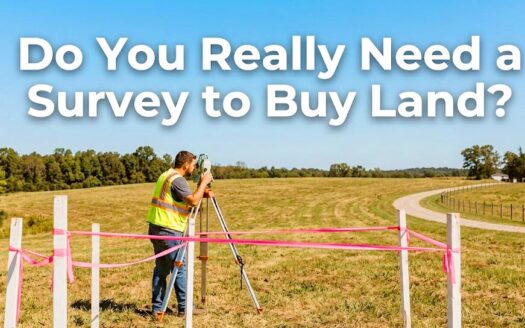
Do You Really Need to Hire a Professional Surveyor?
A common question buyers ask is whether they need to hire a licensed professional through an organization like the National Society of Professional Surveyors (NSPS).
The short answer? It is entirely optional! While hiring a surveyor is a great step if you plan on pouring a concrete foundation or building a permanent structure right on the property boundary, it is by no means a requirement to buy land. If you are using the land for recreation, camping, off-grid living, or long-term investment, the combination of a plat map, county GIS data, and handheld GPS apps like onX Maps is usually more than enough to give you total confidence in your borders without the extra expense.
Your Boundary Toolbox: At an Easy Glance
| Tool | What It Tells You | Is It a Must? | Best For |
|---|---|---|---|
| Plat Map | Exact legal dimensions and shape of the lot. | Provided by Seller if they have | Reviewing dimensions from home. |
| onX Maps App | Your exact physical location relative to the borders. | Highly Recommended | Walking and scouting the land in person. |
| County GIS | Satellite overview of how the parcel sits. | Free Online | Initial research. |
| Professional Survey | Staked, legally binding corners. | Optional | Building permanent structures or fences. |
The Bottom Line
Not being able to see property lines at first glance is completely normal when dealing with beautiful, undeveloped land. By utilizing a seller-provided plat map, tracking your steps with handy apps like onX, and checking for existing pins, you can buy your next property with total peace of mind.
Ready to find your next great piece of real estate? We do the heavy lifting so you don’t have to. Check out our available land for sale and browse our transparent land guides over at the CheapLandFarm Blog.